
Following a few requests for more detailed information about our trip, I have decided to put together some details with links for routes on Google Maps, so no photos or videos in this post, but suggestions for an itinerary which will show you some of the most beautiful parts of our country, especially if you do it in flower season, which is usually sometime between mid August and early October.
Please click on underlined text to follow the relevant links.
The resources we used in planning the trip were Google searches, Google maps, SANParks website, Booking.com and Mountain Passes South Africa website
Day 1: Summerstrand to Lentelus Farmstay, Barrydale, via Steytlerville :
Blog post and photos for Day 1 here
In Steytlerville, visit The Verandah Coffee Shop and Pegasus Early Motoring Museum
Barrydale is an interesting town, which we will definitely explore in more depth in future. For now, Lentelus Farmstay, approximately 10 km outside Barrydale, was a comfortable overnight stop.
Blog post and photos for Day 2 here
Bainskloof Pass is a lovely drive for those who enjoy mountain passes and history and has been declared a National Monument.
Postberg section of the West Coast National Park is only open during flower season, but the rest of the Park is open all year round. Plan to spend around 3 hours in Postberg.
Orca House offers magnificent accommodation right on the beach, is well appointed and very comfortable. Enjoy the sunset on a dune with a glass of wine in hand.
Day 3: Orca House Yzerfontein to Dogstone Cottage, Hondeklipbaai with a detour to Maskam Guest Farm
Blog post and photos for Day 3 here
Quite a few areas of gravel road, some better than others, in this stretch. We were also warned not to take the Hondeklipbaai turn off from the N7 just after Garies, but continue to the Klipfontein turn which is tarred to about halfway to Hondeklipbaai.
Along the way, a detour to Maskam Guest Farm for flower viewing and a light lunch, is quite worthwhile.
Dogstone Cottage offers lovely accommodation in Hondeklipbaai, but one must be aware that this is a very far off the beaten track little town or perhaps rather settlement, at first glance looking somewhat run down, with no fuel available (so fill up in Garies), the shops only stocking basics, the tap water a bit brackish (so take own drinking water), but probably two of the best and most affordable seafood restaurants in South Africa. Rooi Spinnekop was our favourite, but absolutely nothing wrong either with Dop en Kreef and I would suggest everyone should try both and determine their own favourite.
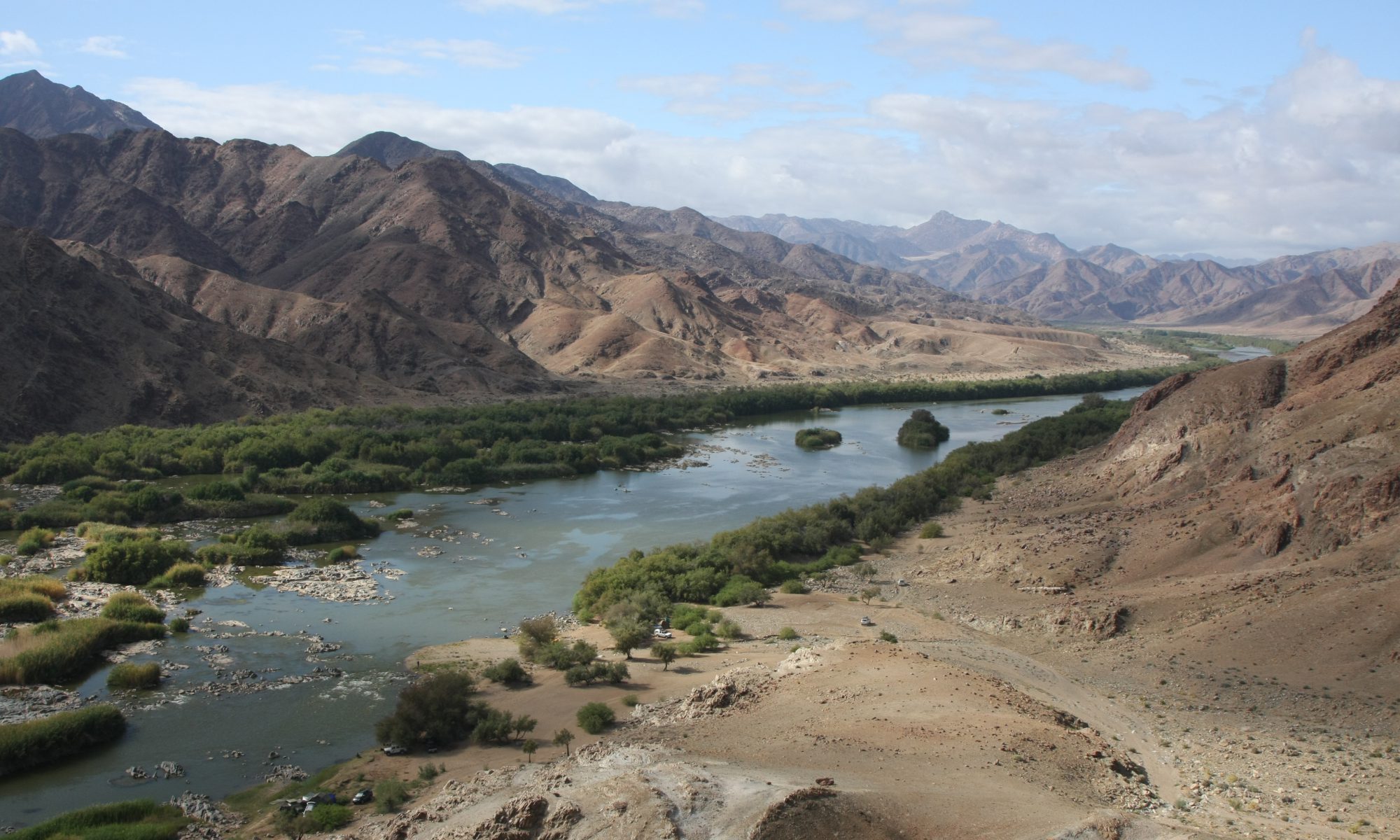
Day 4: Dogstone cottage Hondeklipbaai to Skilpad section of Namaqua National Park and back
Blog post and photos for Day 4 here
Google maps or your GPS will show you a shorter route, but the locals in Hondeklipbaai warned us that some of the routes in the region carried virtually no traffic and that getting stuck on those could result in a day or two’s wait for help. If traveling alone, it is therefor recommended to stick to the more frequented roads. For that reason, we took the road back via Klipfontein to the N7 and on to Kamieskroon and then to Skilpad. At Skilpad there are short hiking routes, which we did not explore due to the rain, as well as two short circle routes which can be driven. One of these is labeled 4×4 only, but in fact can easily be driven with a high ground clearance vehicle without 4×4 capability.
Day 5: Hondeklipbaai to Clanwilliam, with a detour to Graafwater
Blog post and photos for Day 5 here
A visit to Ramskop Nature Garden in Clanwilliam is quite a treat. This apparently used to be magnificent, became quite run down under municipal management, but enthusiastic locals are busy restoring it to its previous magnificence.
Day 6: Clanwilliam – Biedouw Valley – Wupperthal – Eselbank – Mount Ceder
Blog post and photos for Days 6 and 7 here
Biedouw Valley is famous for its flowers. Unfortunately we visited on a cold, rainy day and did not see it in its full glory, but from what we saw, certainly on our list of places to return to.
Do not be fooled by Google Maps telling you this is only 2h47min drive. Eselbank pass, which is supposedly a 4×4 route, although the locals apparently drive there with their Nissan NP200’s, will slow you down and at one point your GPS will start adding on two minutes to your ETA for every one minute you drive. But it is completely worth it for the amazing scenery.
Mount Ceder offers a range of accommodation options. We stayed in a lovely self catering Villa overlooking the valley, a great spot for astro photography, if only the clouds would have allowed.
Day 7: Mount Ceder to Cape Town
Some more lovely mountain passes along this route, but we drove it in pouring rain and howling wind, would like to go back there in better conditions, for photography.
If you like my content and want to be informed when I post again, please subscribe, you won’t be spammed.
